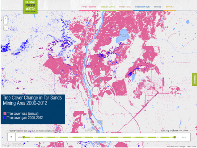
A time-lapsed map released today by the World Resources Institute using satellite imagery from Global Forest Watch shows how much forest is being lost in Northern Alberta to make way for major industrial operations, mainly to extract oil from the tar sands, also referred to as the oilsands.
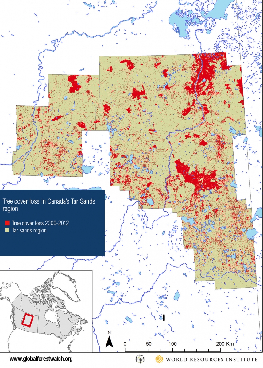
According to the data compiled by Global Forest Watch, industrial development and forest fires in Canada’s tar sands region have cleared or degraded almost 2 million acres (775,000 hectares) of boreal forest since 2000.
The pink regions depict forest loss. Watch what happens at year 2010:
The World Resources Institute and Global Forest Watch have been researching the world’s boreal forests since 1990. According to their research, Canada holds the vast majority, 54 per cent, of the world’s total boreal forest across a region of 500 million hectares or 14 times the size of California. Boreal forests hold twice as much carbon dioxide as tropical forests.
Another map shows tree loss in the tar sands region between 2000 and 2012.
For more images, visit the World Resources Institute website.
Subscribe to our newsletter
Stay up to date with DeSmog news and alerts


